

Local development plans are valid for the territory of the Municipality.
Municipality of Peja, all development plans and others, has planned only within the administrative boundary in 70 of its cadastral areas. The surface of the Municipality of Peja, with all cadastral areas, it is written documents and strategic plans of the developmental, is 603km2. At the same time, the border shown in the map below was the administrative border between the municipality of Peja and Municipality of Plav and Rozaje of Montenegro. Administrative line between Kosovo and Montenegro, now the Republic of Kosovo border with Montenegro is identical with the border marked by the state commission.
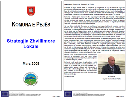
Peja Municipality has prepared a development plan called “Local Development Strategy” in March 2009 under the leadership of Mayor Mr. Ali Berisha. The project was supported by the EU as seen in the logo. A copy of the official document is stored in the EU.
Mayor of Peja z. Ali Berisha on page 2 of the Local Development Strategy thanks supporters and experts and this strategy calls “… a document of particular importance” for the Municipality of Peja.
See below the speech of the Mayor from page 2 of the Strategy of Local Development, (quote) “In this context I am pleased to congratulate you for the work you have done in preparation, using the opportunity here to thank as for the financial support of the European Commission as well as implementer this project, BDPA-in “.
“Once again, I congratulate you for the preparation of this document of particular importance for the Municipality of Peja, which paves an important path but, at the same time, very challenging for the Municipality of Peja. In this case from my side and my staff, I promise that there will be ongoing institutional support to achieve the objectives of this strategy “.
Statement of Mayor of the Municipality of Peja is attached below, along with the cover of the Local Development Strategy Peja 2009.
In this project there are two things very clearly.
First on page 22, Chapter 3.1 Summary of the Municipality of Peja, The area and population (quote)
“The city of Peja is located in centre most of western part of Kosovo, at the foot of the” Accursed Mountains “rising over the Rugova Valley. Peja municipality is divided into 27 territorial units that include a total of 76 villages. The municipality covers 603 km² with a population of around 160,000 inhabitants “.
If the Municipality of Peja lost territory as claimed 82 km2 Municipality of Peja would now have 521 km2, and if join 82 km2 pretended, Peja Municipality will have 685 km2. Of course, the Republic of Kosovo would have 10988 km2. Kosovo this area never had.
Second, on page 23, an important issue in local development strategies 2009 is Peja map that directly relates to the border between the municipality of Peja, Republic of Kosovo and the Municipality of Plav Montenegro.
On this map is seen the boundary of the municipality, the province and the international border as noted in the legend of this map (top right corner of the map). Map of this official document from the Municipality of Peja is without Bjelluha, Çakor and Kulla.
Peja official map submitted in projects for economic development strategies as is “Local Development Strategy” has the border of the Municipality of Peja, of course the border of the Republic of Kosovo with Montenegro is not changed in the 1974-1988-2008- 2015.
In preparation of this Local Development Strategy for Peja were engaged over 50 experts from the staff of the Municipality of Peja and others, for various professional purposes.
Is it possible that in 2009, the Mayor of Peja, Mr. Berisha to be so enthusiastic about the strategy or the special document, and over 50 experts engaged and did not have in this strategy at all Bjelluha, Çakor and Kulla?
Again the question arises, whether all these local experts and two (2) former mayors of Peja, Mr. Ali Lajçi and Mr.. Ali Berisha, who drafted and approved official documents and development strategies of the Municipality of Peja, who called it “… a document of particular importance”, why left out and did not foresee to develop Bjelluha , Çakor and Kulla? ? !!
Peja municipality in late 2009, began implementing a digital project called GIS cabinet. In this web page is also presented the Municipality of Peja map with all 70 cadastral areas. This web-GIS map of Peja has the same border line since 1974-1988-2008-2015. This means that the line defining the Municipality of Peja, Kosovo and Montenegro, is the same as that recorded by the State Commission.
Perhaps former mayor Mr. Ali Berisha, like his predecessor Mr. Ali Lajçi have left that Bjelluha, Çakor and Kulla to place on the next strategy after 2025 as the 2006-2025 development plan.
This shows that the former Mayors of Peja, Mr. Lajçi, Mr. Berisha and current Mayor Mr Muhaxheri have clearly ruled that administered with the Municipality of Peja of 603km2 with 70 cadastral zones. Knowing that private properties, state, public, religious properties are registered then Peja Municipality does not include other territory. Not to create confusion because legally it is known that there is no state territory outside the municipalities because the territory of Kosova is comprised of 38 municipalities with their cadastral areas.
The State Commission has worked with precision and on the basis of official documents for the border line between the Republic of Kosovo and Montenegro of the period 1974-1988-2008-2015. This confirms that the State Commission did not leave any square meter outside the territory of the Municipality of Peja which it had, or did not leave outside any square meter of territory of the Republic of Kosovo.
Last modified: 15 Gusht, 2016